Car hire
Exploring beyond Cozumel is easiest with your own wheels — compare prices for Cozumel:
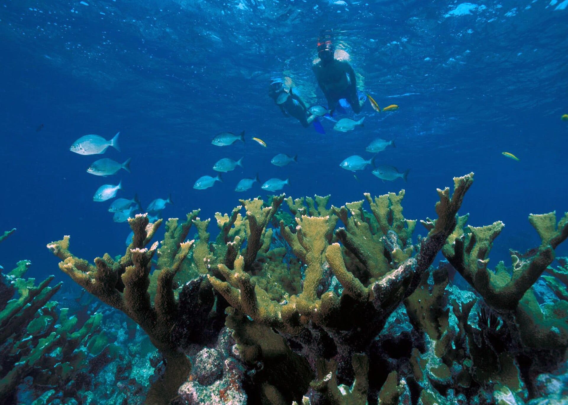
Car hire in CozumelJacques Cousteau put Cozumel on the map in the 1960s and the visibility — routinely forty metres — still does the selling.

The island's west coast is one long marine park where a gentle current carries you over Palancar's coral gardens, making drift diving feel like flying without effort. Beginners can shore-snorkel at Chankanaab or take a first dive with one of the many patient operators. Ferries cross from Playa del Carmen in forty-five minutes; check the cruise-ship schedule and pick a quiet day.
Featured in Ten tropical snorkel and dive spots perfect for first-timers
Daytime highs run from about 26°C in January to 29°C in August. Driest in March and April; wettest in October, with rain on about 20 days. The sea is warmest in September at around 31°C, coolest at 27°C.
The year at a glance — pick a month for detail
August29° · rain 18 days · sea 31°Warm and often wet.
Monthly figures averaged from daily records for 2020–2024 at this location (ERA5 reanalysis). Live conditions from MET Norway, CC BY 4.0.
Pick a budget to open live availability in Cozumel. Prices are per night for two people.
Los Angeles Cozumel, Mexico
Fly from anywhere — search 4,000+ airports worldwide.
Roughly 4h 40m in the air from Los Angeles (LAX), estimated from the distance — check for a direct route. Pick a month to see every available flight with live prices.
Pick your departure date, then your return.
Search flightsNot sure when? Compare fares across a whole month.
Flight times are estimates; prices open on Google Flights.
Exploring beyond Cozumel is easiest with your own wheels — compare prices for Cozumel:
Car hire in Cozumel
Elsewhere in Mexico